 listicle
Professional Drone Photography for Listings: Key Benefits
Table of Contents
- Why Drone Photography for Listings Matters in Real Estate
- How Aerial Perspective Transforms Property Presentation
- Showcasing Property Boundaries and Neighborhood Context
- FAA Part 107 Requirements for Real Estate Drone Work
- Best Practices for Aerial Property Photography
- Real Estate Drone Photography Pricing and ROI
- The Competitive Edge: Faster Sales and Higher Engagement
- Frequently Asked Questions
Last Updated: September 26, 2026
Why Drone Photography for Listings Matters in Real Estate
The real estate market has shifted. Buyers now expect to see properties from angles that ground-level photography simply cannot provide. Drone photography for listings has become essential because it shows what matters most: the property's relationship to its surroundings, the size of the lot, and the quality of the neighborhood context all at once.
Most agents rely on traditional photography alone, leaving money on the table. Aerial perspective gives buyers information they actively want before competitors do.
Properties with drone photography get more engagement, attract serious buyers faster, and often command better offers because the full scope of the property is immediately clear (Drones).
How Aerial Perspective Transforms Property Presentation
From the ground, a home looks like a single structure. From above, it becomes a complete asset, you see the roof condition, driveway layout, pool placement, lot size relative to neighbors, and property boundaries all in context.
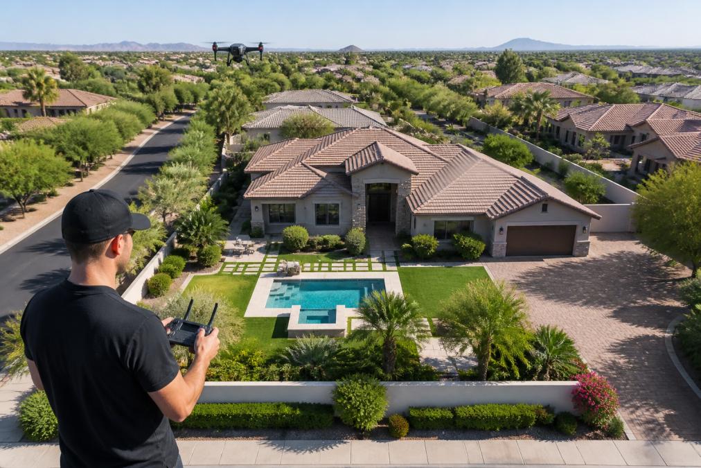
Drone photography for listings answers the questions buyers have before stepping foot on the property: How much land comes with this home? Is the lot corner or interior? What's the neighborhood like from above?
Aerial imagery builds buyer confidence by revealing features, large backyards, mature trees, proximity to parks, that aren't obvious from ground level, leading to faster decision-making and higher perceived value.
Showcasing Property Boundaries and Neighborhood Context
Property boundaries are abstract on paper; from the air, they become concrete. Drone photography for listings makes boundaries immediately visible, eliminating confusion and building trust.
Aerial imagery shows nearby parks, schools, shopping areas, and traffic patterns, revealing neighborhood density, surrounding property quality, and overall character, information that significantly influences buyer decisions.
Showcasing property boundaries and neighborhood amenities through aerial photography provides information other listings don't, winning attention and generating more inquiries in competitive markets.
Professional drone operators position camera angles to highlight attractive elements, time shots for optimal lighting, and capture the property in neighborhood context, elevating your listing above standard photography.
FAA Part 107 Requirements for Real Estate Drone Work
FAA Part 107 regulations govern all commercial drone operations in the United States, including real estate photography.
Key FAA Part 107 requirements include:
- Remote pilot certificate required for any commercial drone work (this is the FAA's formal credential)
- Drone registration with the FAA
- Line-of-sight operation at all times (operator must maintain visual contact with the aircraft)
- Maximum altitude of 400 feet above ground level
- No flying over people or moving vehicles
- Daylight operations only (with limited exceptions)
- Minimum 500-foot distance from airports and helipads
Compliance is non-negotiable. Hiring a drone operator with an FAA Part 107 remote pilot certificate ensures your shoot is legal, insured, and protects you from liability.
Best Practices for Aerial Property Photography
Professional aerial photography requires strategy, technical skill, post-production expertise, and understanding when drone photography is appropriate.
Production best practices that separate professional results from amateur footage:
Plan the shoot around lighting. Golden hour (first hour after sunrise or last hour before sunset) produces the best aerial imagery. The low sun angle creates depth and reduces harsh shadows. Midday sun flattens images and obscures details. Professional operators schedule shoots during optimal light windows.
Establish multiple angles and elevations. Professional drone photography for listings includes wide establishing shots, medium angles revealing boundaries and lot size, and closer angles highlighting pools, architectural details, or landscaping.
Capture both static and dynamic footage. Still images work for listing portals; video adds motion and storytelling. Professional operators use smooth camera movements and consistent flight paths; jerky movements signal amateur work.
Handle post-production carefully. Color correction, exposure balancing, and hand-blended imaging make the property look its best while maintaining realism. Amateur operators often over-process (artificial) or under-process (flat) footage. Professional post-production requires skill and restraint.
Integrate aerial footage with ground-level photography. A complete listing includes aerial overview shots, ground-level detail photos, and interior images, giving buyers confidence they understand the property fully.
Critical limitations and constraints that determine feasibility:
Airspace restrictions: The FAA restricts drone operations in Class B, C, and D airspace around major airports, military installations, national parks, and temporary flight restriction zones. Properties near airports may be in restricted airspace, making drone photography impossible without special FAA authorization (rarely granted for real estate). Professional operators check airspace restrictions before committing to a shoot.
Weather constraints: Wind is the primary constraint; professional drones operate safely in winds up to 20-25 mph, but optimal results occur under 10 mph. Rain, fog, and low cloud cover prevent flying. In regions with frequent cloud cover or seasonal wind patterns, scheduling requires flexibility.
Liability and insurance considerations: Professional drone operators carry liability insurance covering property damage and bodily injury. Always verify current insurance and that it covers real estate photography. Unlicensed operators typically carry no insurance, exposing you to significant liability.
Seasonal and time-of-day limitations: Drone operations are restricted to daylight hours under FAA Part 107. Winter shoots in northern regions have narrow daylight windows. Properties with heavy tree cover or surrounded by tall buildings may have limited feasible angles.
Neighbor and HOA considerations: Some properties have HOA restrictions prohibiting drone operations. Flying over neighbors' property can create legal complications. Professional operators work within property boundaries whenever possible.
When to skip drone photography: Avoid drone photography for properties in restricted airspace, areas with persistent poor weather, HOA restrictions, urban townhomes with minimal exterior features, unattractive neighborhoods, or poor property condition. A professional operator will advise honestly if drone photography isn't a good fit.
Real Estate Drone Photography Pricing and ROI
The real question agents ask is not what drone photography for listings costs, it's whether it pays back.
Typical pricing structure for professional drone photography:
Measuring ROI: The metrics that matter
The real value emerges when you track what drone photography actually delivers:
-
Days on market reduction: Properties with professional aerial imagery typically sell 5-15 days faster. A 10-day acceleration saves $500-$1,500 in carrying costs, often exceeding the drone photography investment.
-
Price premium: Listings with drone photography frequently command 1-3% higher sale prices in competitive markets. On a $500,000 property, a 2% premium equals $10,000, a 12x return on an $800 investment.
-
Inquiry volume and showing conversion: Listings with drone photography receive 20-40% more online inquiries and showings per week, compressing the sales timeline and increasing multiple-offer probability.
-
Online engagement metrics: Properties with drone photography average 2-3x longer time-on-page and 40-60% higher click-through rates, translating into faster sales and better offers.
ROI calculation framework for agents
This calculation assumes the property is priced competitively and marketed effectively. Drone photography amplifies good marketing; it does not rescue poorly positioned listings.
When drone photography delivers the strongest ROI
Drone photography ROI is highest for:
- Properties $400,000 and above (price premiums are larger in absolute dollars)
- Listings with significant land features (pools, acreage, mature landscaping, corner lots)
- Competitive markets with multiple similar properties for sale
- Properties with strong neighborhood amenities visible from above (parks, waterfront, golf courses)
- Agents managing 10+ listings monthly (cost per listing decreases with volume)
ROI is weaker for:
- Properties under $250,000 in slower markets (fewer competing listings, lower price premiums)
- Urban townhomes or condos with minimal exterior features
- Properties in restricted airspace (near airports, military installations) where drone photography is not permitted
- Listings with poor condition or unfavorable neighborhood context that no photography can overcome
Rather than guessing at costs, reach out to a professional drone operator for a quote tailored to your specific property. Pricing depends on the scope of work, and a professional can assess your property and provide accurate pricing based on what you actually need. More importantly, a professional can help you estimate realistic ROI based on your local market conditions, comparable sales data, and current days-on-market trends.
The Competitive Edge: Faster Sales and Higher Engagement
Properties with professional drone photography for listings generate measurable competitive advantages. They receive more online views before the showing appointment. They attract more serious inquiries because the visual presentation is more comprehensive. They often sell faster because buyers have already made a preliminary assessment based on the aerial imagery.
This competitive edge matters most in markets with inventory. When multiple similar properties are for sale, the listing with superior visual storytelling wins attention.
Frequently Asked Questions
Do I need an FAA Part 107 license for real estate drone photography?
Yes. Any commercial drone work, including real estate photography, requires the pilot to hold an FAA Part 107 Remote Pilot Certificate. This ensures liability coverage, compliance with airspace rules, and professional standards. When you hire a drone operator, verify they hold this certification. It protects both you and your clients from legal and insurance complications.
How much does professional drone photography for listings typically cost?
Real estate drone photography pricing depends on quantity, property size, delivery timeline, and editing complexity. For accurate pricing tailored to your portfolio volume and needs, contact Desert Home Photography directly for a quote based on your specific requirements.
How does drone photography actually impact time on market?
Properties with aerial imagery and video tours attract more qualified buyer interest upfront, reducing days on market. The bird's-eye view showcases property size, land features, and neighborhood positioning in ways ground-level photos cannot. This visual storytelling draws serious buyers faster and can support higher listing engagement across digital marketing channels.
What's the difference between professional drone photography and standard listing photos?
Professional drone photography captures unique aerial perspectives that standard photos miss: property boundaries, lot size, landscape features, and neighborhood context. Combined with hand-blended editing and color correction, aerial imagery creates a complete visual story that ground-level shots alone cannot tell. This comprehensive approach increases marketability and buyer confidence, especially for luxury and land-heavy properties.