 listicle
Aerial Drone Footage for Property Sales: 7 Key Benefits
Table of Contents
- How Aerial Drone Footage Showcases the Full Property
- Real Estate Drone Photography: Showing Location and Neighborhood Context
- Highlighting Land, Lot Size, and Property Boundaries
- Drone Photography Tips for Real Estate: Capturing Unique Features and Amenities
- The Sales Impact: Faster Listings and Higher Perceived Value
- Drone Photography Cost for Real Estate and ROI Calculation
- FAA Part 107 License for Real Estate Photography: Compliance and Safety
- When Aerial Footage Is and Isn't Worth the Investment
- Frequently Asked Questions
Last Updated: October 12, 2026
How Aerial Drone Footage Showcases the Full Property
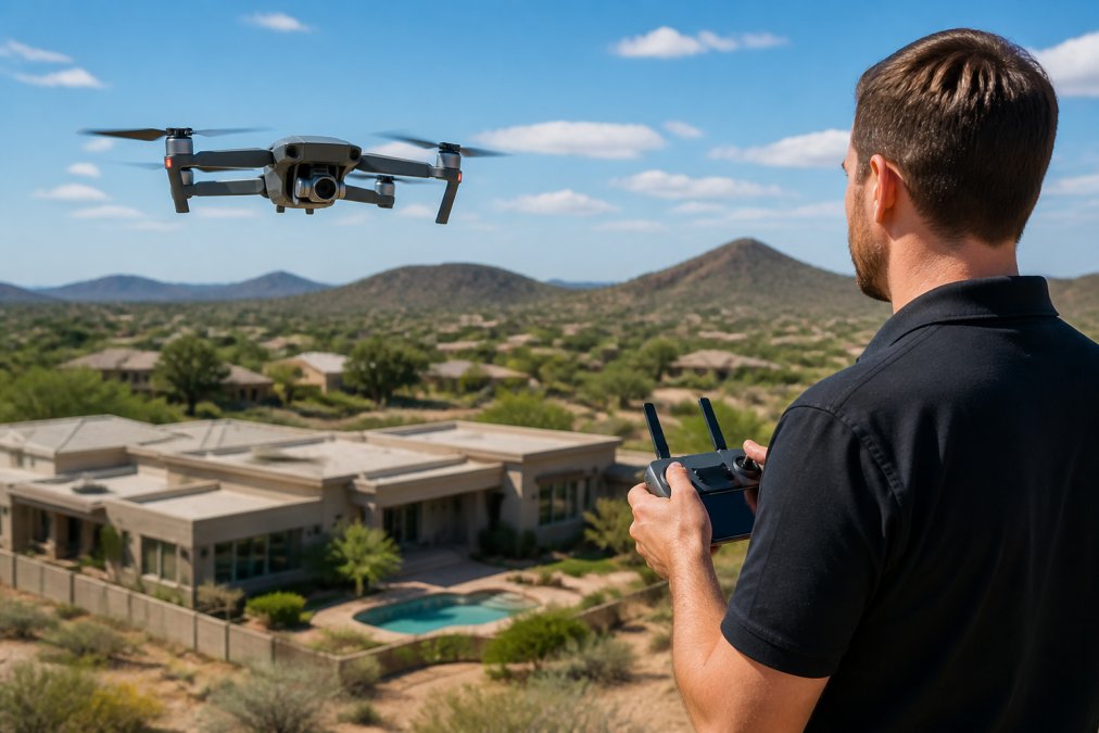
Aerial drone footage property sales reveals what ground-level photography cannot: the full property footprint, the relationship between the house and its surroundings, and the true scope of what buyers are considering.
Most buyers make their first impression from listing photos, so traditional angles hide critical information. Aerial views demonstrate scale, layout, and context in seconds, stopping the scroll.
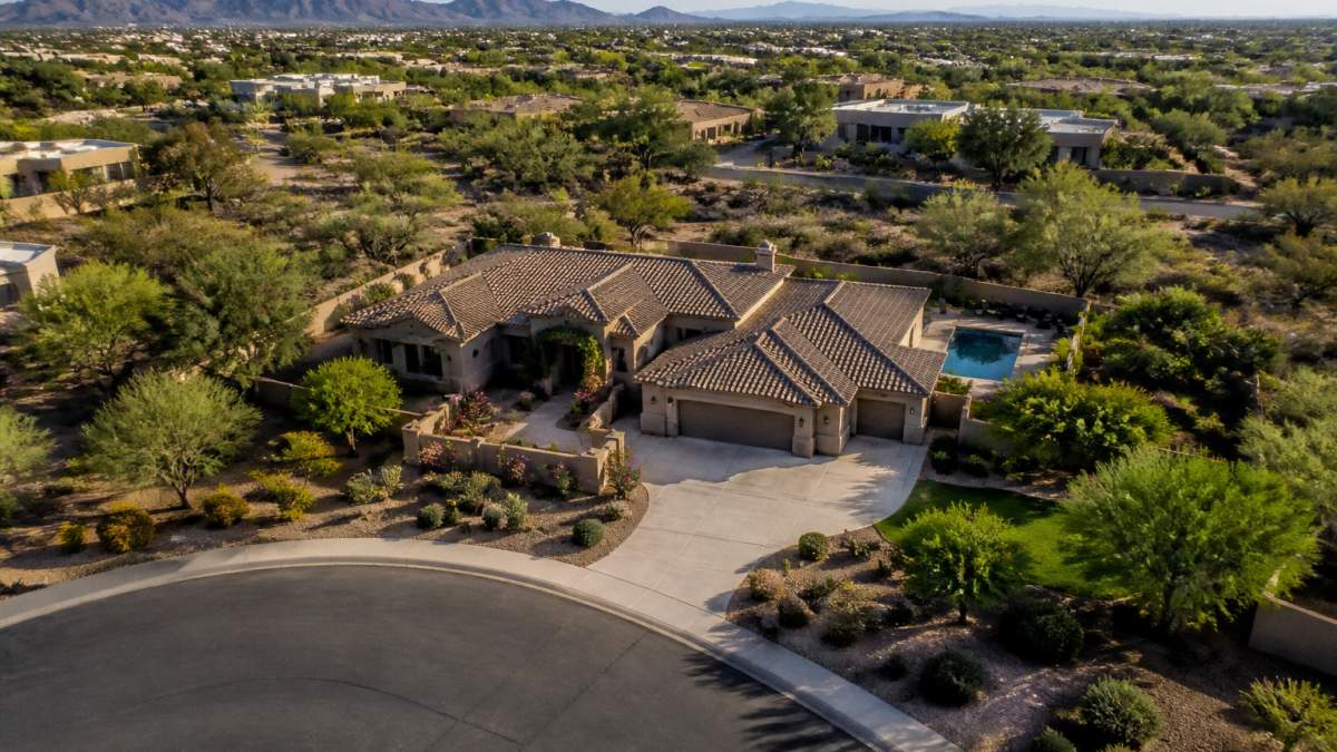
At Desert Home Photography, we know aerial drone footage for property sales works because it answers buyers' questions before they call: How big is the lot? What does the neighborhood look like?
Properties with aerial drone footage attract more qualified leads because buyers have already confirmed the property meets their basic requirements, calling with genuine interest rather than curiosity.
Real Estate Drone Photography: Showing Location and Neighborhood Context
Location context is one of drone photography's most underrated advantages. Ground-level photos show a driveway; aerial shots reveal proximity to parks, schools, shopping centers, and major roads.
Buyers research neighborhoods obsessively, wanting traffic patterns, amenities, and how the property sits within the broader area. Aerial drone footage for property sales provides that context in one image, without switching to Google Maps.
Agents in competitive markets recognize this immediately: a property near a desirable park, waterfront, or commercial district sells differently when that proximity is obvious. Drone photography makes location an asset rather than a discovery.
This is especially valuable in developing areas or neighborhoods with strong commercial corridors, where the aerial perspective answers: "Is this location actually convenient?"
Highlighting Land, Lot Size, and Property Boundaries
Lot size and land features are hard to communicate in traditional photography, a driveway photo doesn't show how much yard exists behind the house. Aerial drone footage for property sales displays the entire lot and its boundaries clearly.
Investors need lot dimensions and shape, families want adequate outdoor space, and buyers considering expansion need to understand what they're purchasing. Aerial views answer all these questions at once.
Land features become obvious from above, mature trees, landscaping, pool placement, usable outdoor areas, helping buyers visualize how they'd use the space, especially on rural properties where land is the primary asset.
Boundary clarity builds confidence: buyers see exactly what's included, with no ambiguity about where the property ends and the neighbor's begins, reducing questions and speeding decisions.
Drone Photography Tips for Real Estate: Capturing Unique Features and Amenities
Effective aerial drone footage for property sales highlights what makes a property distinctive. Not every home needs it, but homes with unique features benefit.
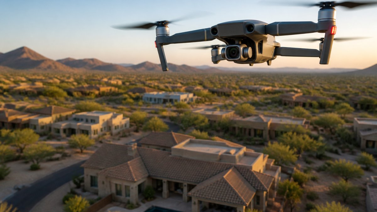
Look for architectural details visible from above, distinctive roof lines, resort-style backyards, extensive landscaping, waterfront access, or significant acreage. These photograph beautifully from the air and become selling points.
Technique matters as much as subject. A shot from 50 feet reveals layout; 100 feet shows relationship to surroundings. Combining angles creates a comprehensive visual story.
Timing affects quality: early morning or late afternoon light beats harsh midday sun, and clear skies with calm winds ensure sharp footage. Poor conditions produce hazy, unstable images that undermine the listing.
Professional operators frame shots that highlight strengths and minimize weaknesses, understanding composition, lighting, and how to tell a property's story from the air, the difference between professional drone photography and amateur attempts.
The Sales Impact: Faster Listings and Higher Perceived Value
Claims that aerial drone footage makes listings sell faster or for more money are common but hard to verify. Aerial imagery is a presentation improvement that influences buyer behavior through measurable intermediate metrics, not a guaranteed price bump.
Better visuals earn more clicks, more clicks produce more views, more views generate inquiries and showings, and more showings create competition. Any effect on days on market or price flows through those steps.
Instead of chasing a headline number, track the KPIs you can actually measure before and after adding aerial media:
- Listing views and click-through rate on the MLS and syndicated portals, compared with similar listings in the same ZIP code and price band.
- Saved/favorited counts and shares, which indicate the visuals are stopping the scroll.
- Inquiry volume and quality, are the calls and messages from buyers who already understand the lot size, layout, and setting?
- Showing requests in the first 7 and 14 days, the window where visual presentation has the most influence.
- Days on market and list-to-sale price ratio, tracked against your own comparable listings rather than a national average.
Agents report the clearest lift on listings hard to understand from the street: large lots, irregular parcels, waterfront or golf-course frontage, and amenities hidden behind the house.
Perceived value is a relative effect. When aerial video is rare it differentiates a listing; as it becomes common it shifts from advantage to expectation, like professional still photography. The strategic question isn't "does aerial footage help?" but "does it help this listing stand out against its current competitors?"
National Association of Realtors profile of home buyers and sellers
Drone Photography Cost for Real Estate and ROI Calculation
Most articles skip the money question, which is why sellers and agents stall. Real estate drone cost isn't a single number, it's a range driven by deliverables, flight complexity, and whether the operator bundles aerial media with ground photography.
What drives the price
- Deliverables. A handful of edited stills is the least expensive option. Adding a 30-60 second edited video, a vertical cut for social, or a 360-degree aerial panorama raises the price at each step.
- Flight complexity. A simple residential lot in open airspace is straightforward. Large acreage, waterfront, or properties near controlled airspace (airports, stadiums, military installations) require more planning and sometimes coordination, which adds cost.
- Editing and turnaround. Same-day or next-day delivery, color grading, music licensing, and captions all carry labor.
- Bundling. Operators who also shoot interior and exterior stills usually price aerial as an add-on, which is cheaper than hiring two separate vendors and scheduling two visits.
- Market. Rates vary widely by metro area, so always request local quotes rather than relying on national averages.
A practical ROI framework
Don't attribute a sale price to a single media asset. Frame the decision as a share of the listing's marketing budget versus the alternatives:
- Cost as a share of list price. For a higher-priced listing, professional aerial media is typically a small fraction of a percent of list price, comparable to a single print ad or a few weeks of boosted social posts.
- Cost per qualified showing. If aerial media produces even one or two additional serious showings, the cost is usually recovered in the value of the agent's time alone.
- Cost of a price reduction. A single price cut typically dwarfs the cost of any photography package. If better visuals help a listing avoid even one reduction, the ROI is strongly positive.
- Cost of extended days on market. Carrying costs, mortgage, taxes, insurance, utilities, HOA, accrue every month a property sits. A few weeks saved usually exceeds the media spend.
When the math does not work
For a small, standard lot in a dense subdivision with no distinctive outdoor features, the aerial view adds little information and the ROI is weak. The same is true when the roof or landscaping is in poor condition, because aerial footage will highlight the problem rather than the property.
How to buy well
Ask for an itemized quote: number of edited stills, video length, number of revisions, delivery format, and whether the operator carries liability insurance and holds a current remote pilot certificate. Confirm who owns the footage and how long it will be hosted. Agents with multiple listings should ask about volume pricing, since repeat work is cheaper to schedule and edit.
FAA Part 107 License for Real Estate Photography: Compliance and Safety
Operating a drone for commercial real estate photography requires an FAA Part 107 license in the United States. It's federal law, not optional.
The Part 107 process involves passing a knowledge test on drone regulations, airspace rules, weather, and safety protocols. Licensed operators understand airspace restrictions, altitude limits, and how to operate safely around people and property.
Liability flows downward: if an unlicensed operator causes damage or injury, responsibility extends to whoever hired them. Using a licensed, insured operator protects you legally and professionally.
Desert Home Photography's team holds FAA Part 107 licenses, which means our drone operations meet federal standards. We understand airspace rules, respect privacy boundaries, and operate safely. This certification is proof that we're serious about compliance and professionalism.
Verify licensing before hiring any drone operator. Ask to see their Part 107 certificate. Confirm they carry liability insurance. These are not optional details, they're the foundation of responsible drone photography for real estate.
When Aerial Footage Is and Isn't Worth the Investment
Aerial drone footage for property sales is powerful but not right for every property.
It's less valuable for interior-focused properties, dense urban areas where aerial views show only rooftops and streets, or markets where ground-level photography is standard.
Condition matters too. If a roof needs replacement or landscaping is neglected, aerial photography highlights problems rather than selling points.
Market timing matters: in slow markets every advantage counts, while in hot markets with multiple offers basic photography may suffice.
The strongest cases for aerial drone footage property sales are distinctive properties in competitive markets where visual presentation influences buyer behavior.
Aerial drone footage transforms how buyers experience listings, revealing scale, location context, and distinctive features ground-level photography can't capture.
Desert Home Photography specializes in aerial drone photography for real estate. Our FAA-licensed operators combine technical expertise with creative composition to capture properties that sell.
Frequently Asked Questions
What are the main benefits of aerial drone footage for selling a property?
Aerial drone footage provides a comprehensive view of the entire property, including lot size, landscape, and surroundings, details that ground-level photos cannot capture. It attracts serious buyers by showcasing unique features like pools, patios, and land acreage, creates attention-grabbing listing visuals that stand out online, and helps buyers understand the property's location relative to the neighborhood.
How much does real estate drone photography typically cost?
Drone photography pricing depends on several factors, including property size, complexity, delivery timeline, and whether you want still images, video, or both. Pricing also varies based on the photographer's experience and whether they hold an FAA Part 107 license. For accurate pricing tailored to your specific needs, contact Desert Home Photography directly for a quote. Many agents find the investment worthwhile when it accelerates sales or increases buyer interest.
Do you need an FAA Part 107 license to fly a drone for real estate?
Yes. Any commercial drone operation, including real estate photography, requires the pilot to hold an FAA Part 107 Remote Pilot Certificate. This ensures compliance with federal regulations, protects property owners from liability, and guarantees the work meets safety and legal standards. Desert Home Photography's team includes FAA-licensed operators, so all drone work is fully compliant and insured.
Should a real estate listing use drone photos, video, or both?
Both formats serve different purposes. Aerial still photography is excellent for showcasing the property's layout, lot size, and landscape in listing galleries. Drone video creates a dynamic, immersive experience that captures movement around the property and engages buyers emotionally. Many successful listings combine both: stills for online portals and search results, video for virtual tours and social media promotion. Your photographer can recommend the best mix based on the property's unique features.